
Exploring Lake Mead National Recreation Area in Arizona
Lake Mead National Recreation Area was the first, and is still the largest, national recreation area in the United States. It was designated by Congress in 1964 and includes over 1.5 million acres. You may think that this is just the lake, but Lake Mead is just a part of this huge park. Lake Mead National Recreation Area actually reaches from the southwestern corner of the Grand Canyon all the way to Katherine Landing at Laughlin, Nevada and Bullhead City, Arizona.
It includes two lakes – Lake Mead, formed by the Hoover Dam; and Lake Mohave, formed downstream by the Davis Dam. There are over 29 square miles of water surface, and much much more. The recreation area also encompasses mountains, canyons and desert, and includes 9 wilderness areas.
Of course Lake Mead National Recreation Area is a haven for water sports, but it is also a great place to get out and hike, in Nevada and Arizona.
White Rock Canyon
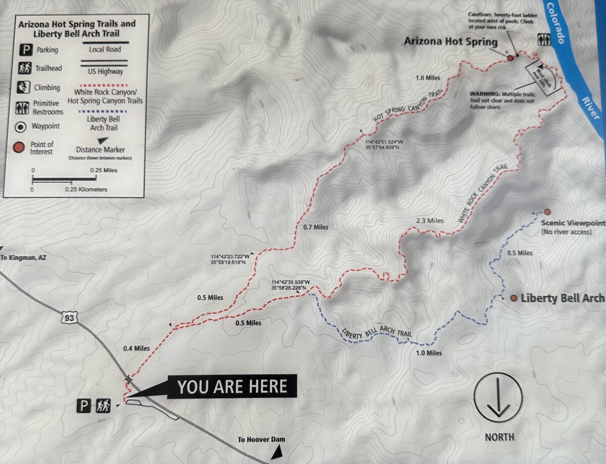
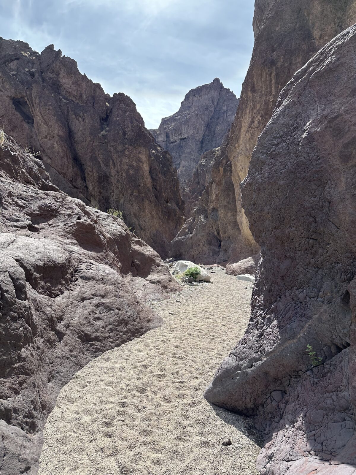
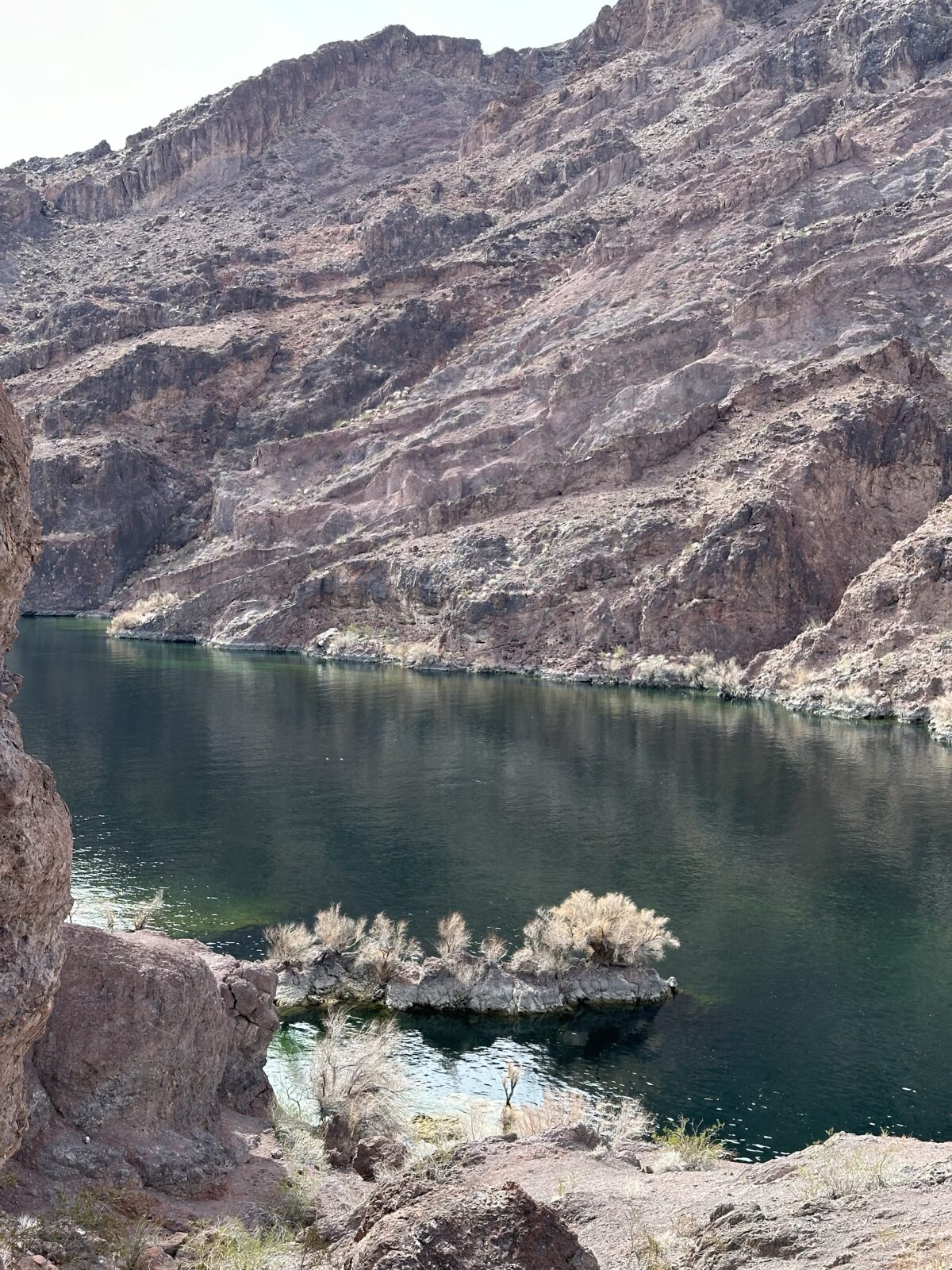
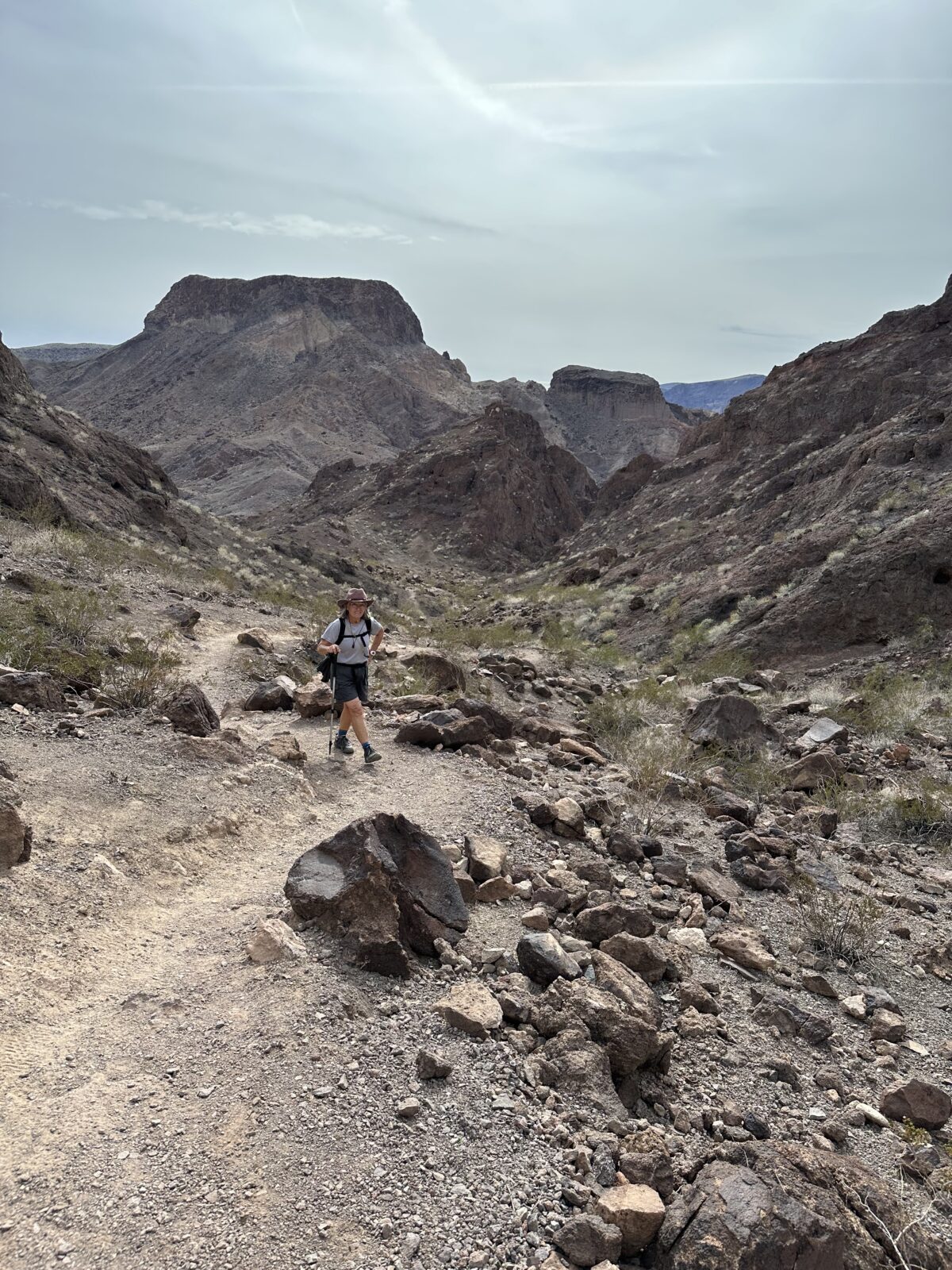
Driving along US highway 93 just south of Hoover Dam, on the Arizona side at about Milepost 4, there is a shared parking lot and trailhead for White Rock Canyon. Most people drive right by this, but we consider it a hidden gem. It is a 3 mile trail that gradually descends through a winding canyon to the Colorado River. It is a moderately easy hike to the river, mainly walking on a gravelly wash with a bit of scrambling over rocks.
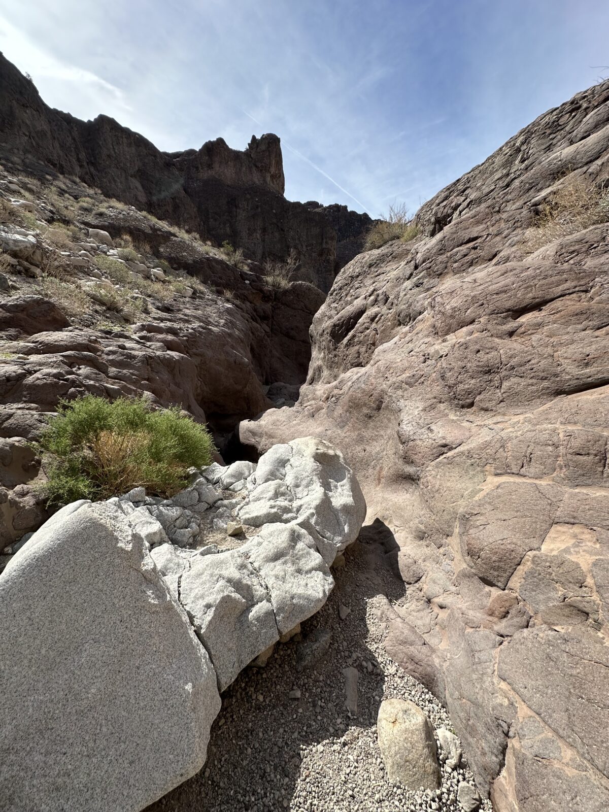
The canyon walls are beautiful, rising a couple of hundred feet on both sides in some places. You can really see the power of water and how it has scoured the canyon walls, leaving debris and rocks several feet above the river bed. It’s a good reminder that you would not want to be hiking on this type of trail when it has been raining. Flash floods in the desert are dangerous!
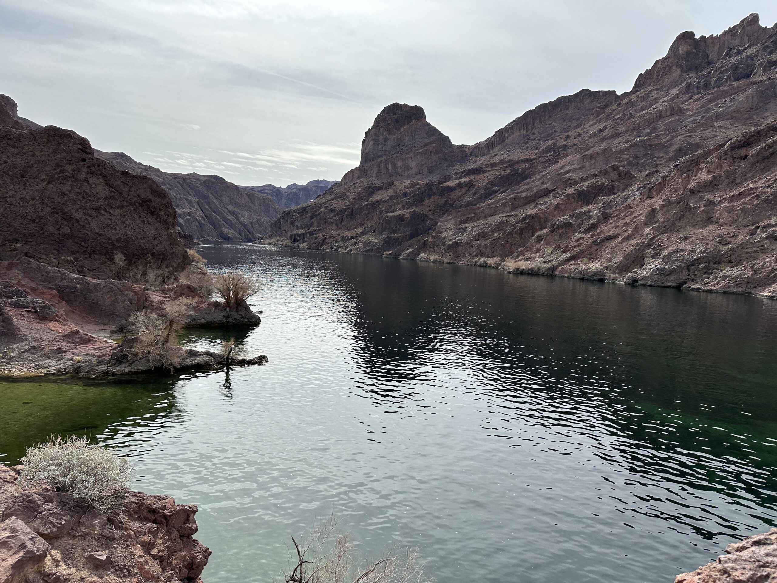
As you get near the river, the trail widens out and then you see the mighty Colorado. You can’t see the Hoover Dam. Where you come out from the trail is a bit down river. This part of the river is gorgeous, almost tropical. The water is crystal clear and turquoise colored, with lots of ducks peacefully floating in the current.
On the sandy shore, you will find a couple of beaches for wading and swimming. It’s a great way to spend a day, but keep a bit of energy for the hike back to the parking lot. It isn’t too strenuous, but it is pretty much all uphill.
Arizona Hot Spring
If you want to add a bit of adventure, take the trail along the river and visit the Arizona Hot Spring. Warning, as the map at the trailhead indicates, here there are multiple trails. The trail is not clear and it does not follow the shore. It climbs over rocks and you will have to do a bit of bouldering. Watch carefully for painted arrows indicating the trail.
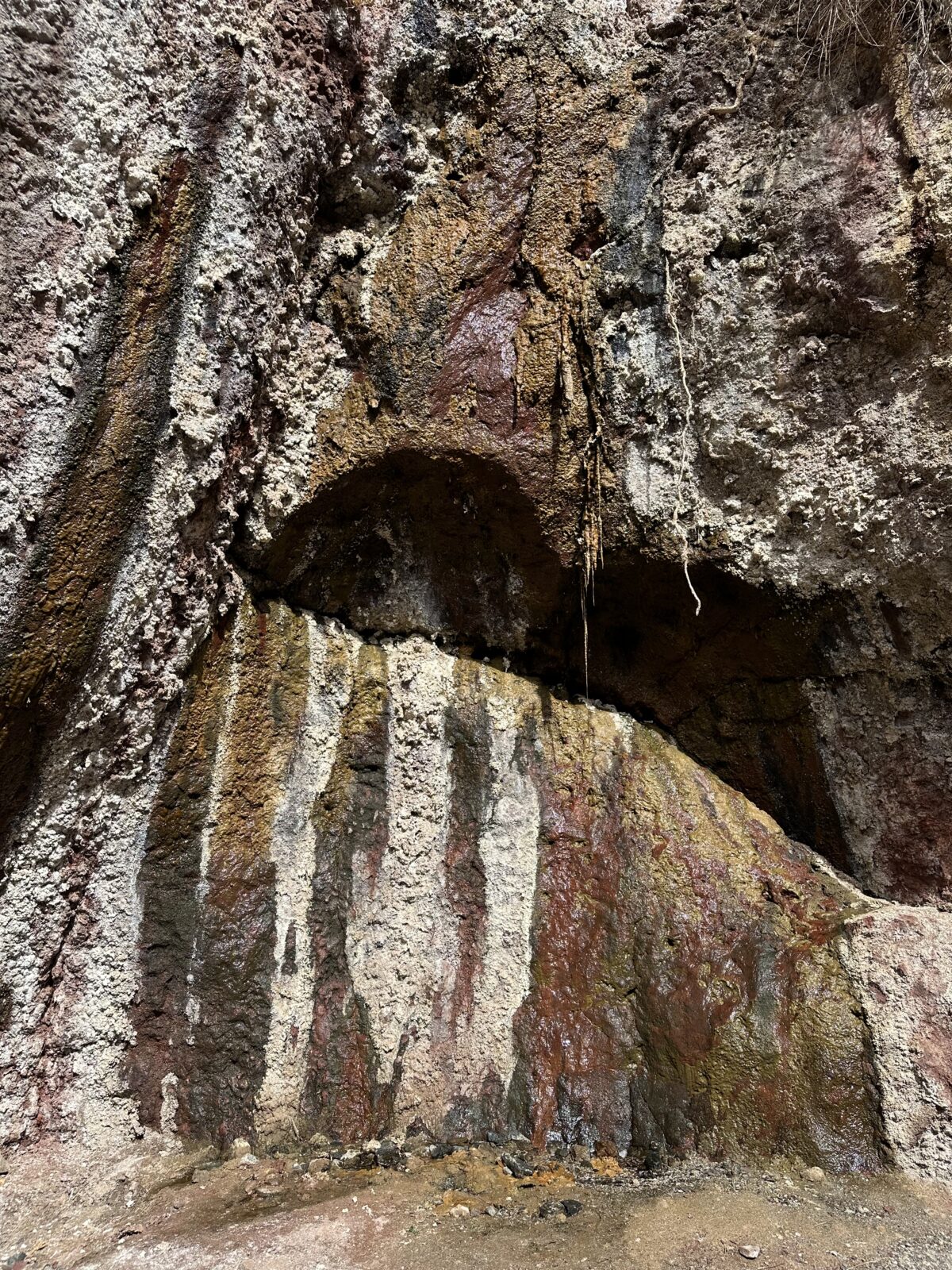
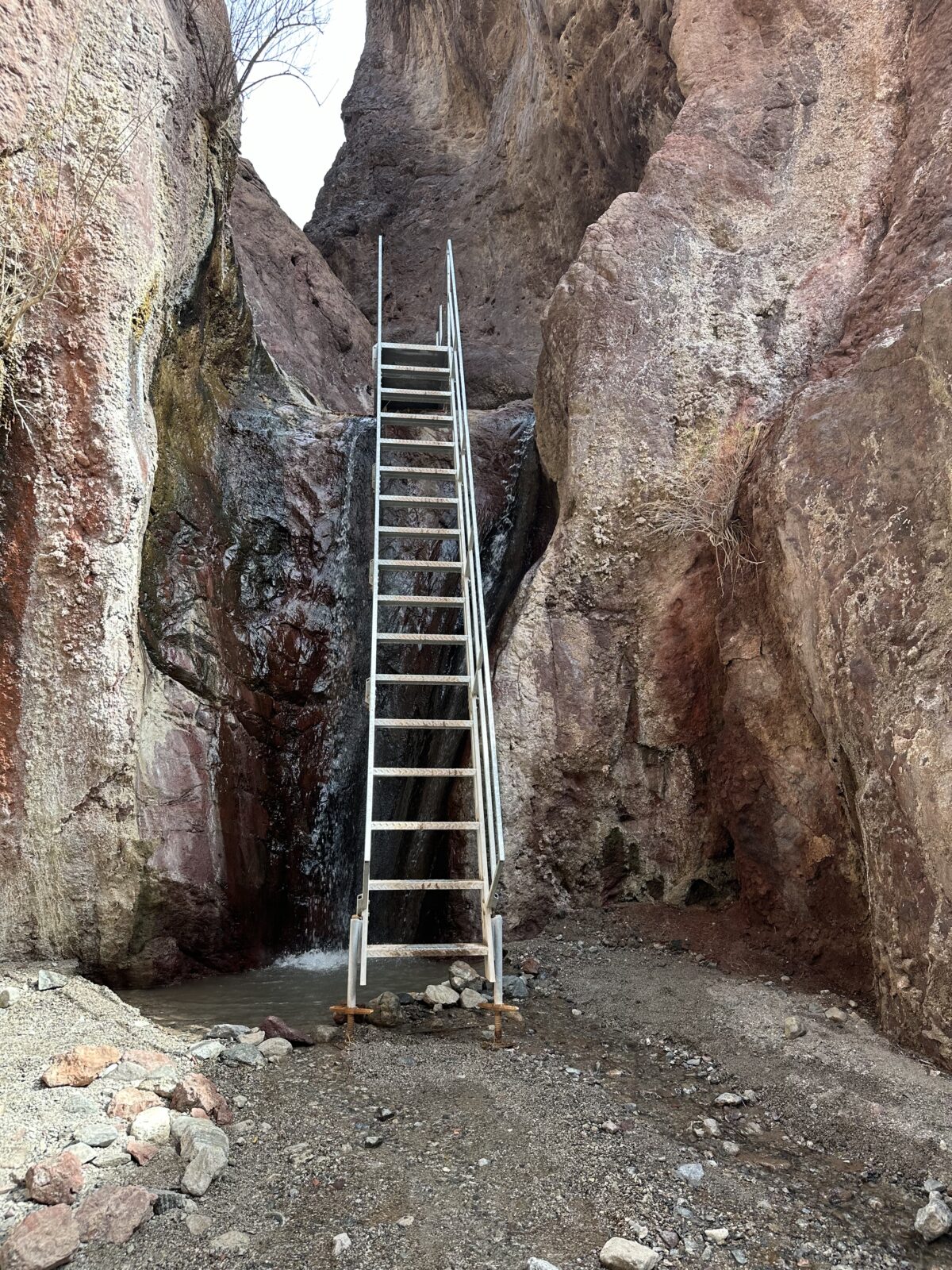
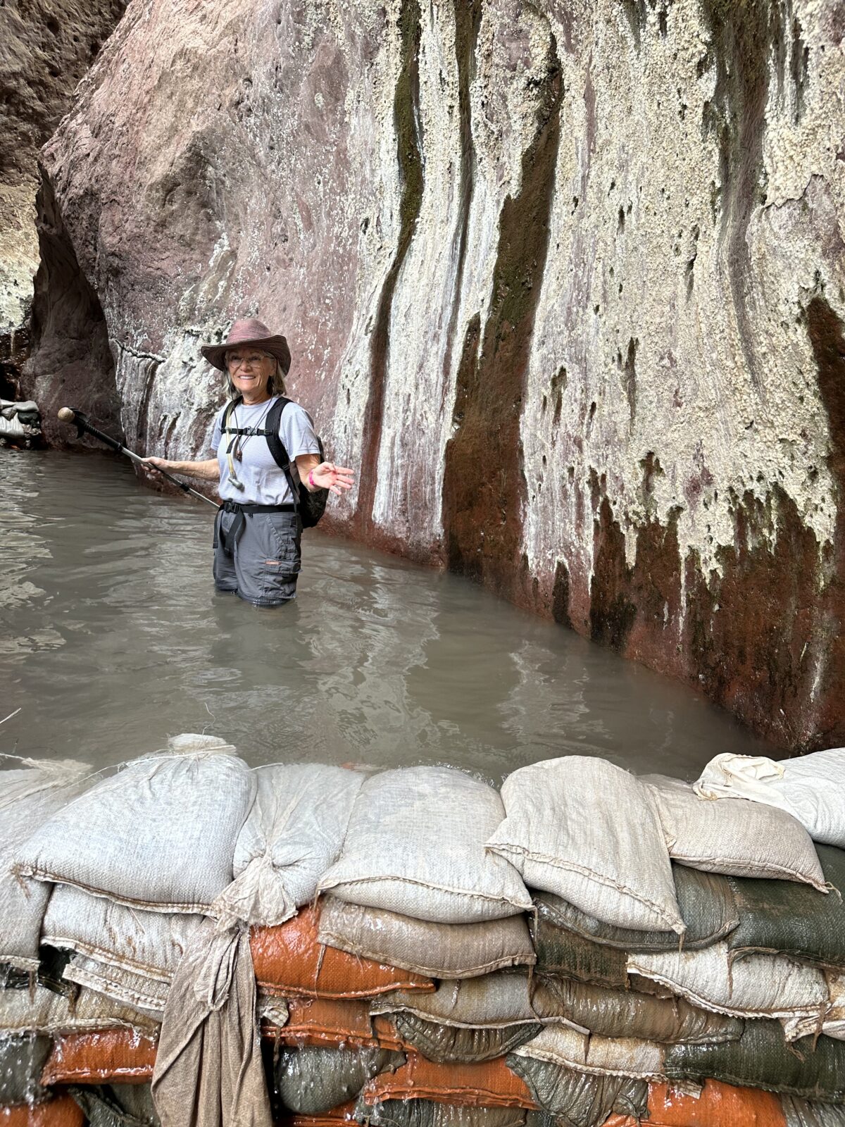
When you come to a small stream, walk left, up stream and away from the river. This takes you to the hot springs. We personally had pictured the hot springs a bit differently – maybe a few big tubs filled with water that you could just walk around. But no, the hot spring is actually a naturally fed river. You walk up the shallow stream and depending on the water level, make your way up a couple small waterfalls. Then you arrive at a much larger waterfall, one that would be very difficult to scale if there was not a 20 foot ladder.
At the top of the ladder, you will see the first hot pool. Basically the hot spring water is flowing through a really narrow canyon where someone has piled sandbags about 3 feet high, to create three pools, each one hotter than the next.
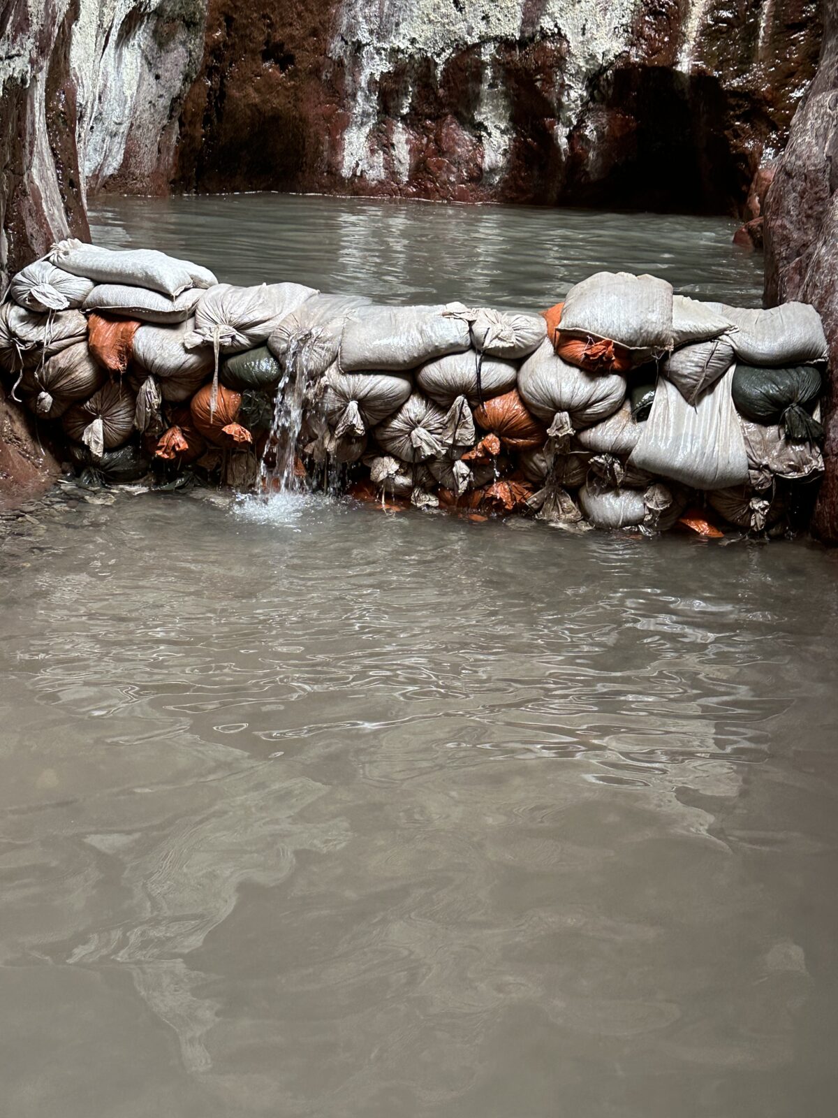
There is no way around the water. You either go back the way you came, and return to the trailhead via White Rock Canyon Trail. Or, you can walk through the pools and continue on the other side up the Hot Springs Canyon Trail back to your car. Best option – bring water shoes and wear a bathing suit! Another option – walk right through the pools in your clothes. They are no more than 3 feet deep and on a typical sunny Arizona day, you’ll dry out as you hike back out!
Hot Springs Canyon Trail
Hiking the full loop – White Rock Canyon Trail and Hot Springs Canyon Trail – adds about a mile to the walk, making it 6.5 miles round trip. The Hot Springs Canyon Trail winds its way through another set of dramatic slot canyons, but then it gets more difficult. There is a long climb up slippery gravel. Total elevation change is 750 feet from the river.
Which direction should you go? That’s a tough one. You will have more shade on the White Rock Canyon Trail as you hike out on a sunny afternoon. But, the hike down Hot Springs Canyon Trail is pretty slippery going downhill on gravel. Poles would be helpful.
Summer Closure
Be aware that all of the trails here are closed from May 15 to September 30 due to extreme heat. Even when we hiked in February it was pretty hot. Be sure to bring plenty of water and wear sunscreen. Check the websites for up to date information.
Are you trying to visit all the National Parks, or National Park Units?
If your goal is to visit them, one or all, we’d love to help you strategize. Give us a call at (480) 609-3978 or drop us a note here. We always enjoy talking with people who share our passion for visiting these gems of the National Park Service.
#FindYourPark
#SeeAmericaFirst